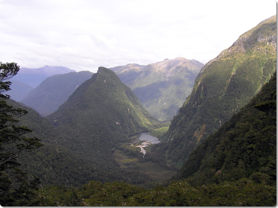
This is the view when I stopped during the climb to sit on
the ledge and turned around. Now perhaps you understand why I got
such a jolt. I really had no idea that this is what was behind
me until I stopped.
The trail skirted the edge of Gair Loch and I remember the section
where one went right between the water and the rock wall, which was
particularly water-sodden area. I was pretty focused on the
trail
at the time and while I knew that there was a rock wall towering above
me, I didn't know that it was quite as spectacular as you see
here. Perhaps from where I was down low it was impossible to
comprehend it's size and it's something only when you stand above it
all and stop for a rest do you really get a perspective on
things. I'm sure life in general is like that, but it's probably
best not to ask me too much about such things.
The trail followed the river north of Gair Loch. If you look
close,
you can see the river's path where the trees are a little taller and
goes from the end of the loch and approaches the rock wall. There
is a large and steep valley between the two ridges that you see on the
right side of the picture. That valley has a river (what else in
Fiordlands?) that joins the Seaforth River which flows in Gair
Loch. The hut is situated at the junction of these two
rivers and is where I took the
nighttime
picture of the Kintail Valley. In the morning, the trail
immediately crosses valley's
river and then hugs the right side of the valley for a while. You
then cross the Seaforth River and climb the on the left of where I was
perched for this picture. Yep, it's a cool place.
